

Nepal floods is not simply a natural disaster. It is a warning about climate change, reckless development and our belief that nature can be controlled

Illustration: Yogendra Anand/CSE

Published on:
14 Sep 2026, 3:02 am
Listen to this article
As I write this, over 1,300 lives are confirmed lost and many thousands are still missing in the floods in Nepal, as the mighty Himalayas came down as rubble. This is an enor-mous and painful human tragedy, but it is also about willful actions and inactions of humans. This tragedy is really about our mindset, the be-lief that we, as humans, can re-engineer everything; that we are in control of the universe and all things in it. We are the supreme beings who can weather climate change, because, after all, it is only about a small and insignificant matter of weather. This is on us.
Nepal-Tibet tragedy explained: ‘Ice-rock avalanche’ triggered flash floods

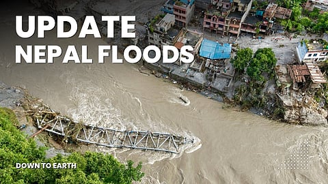
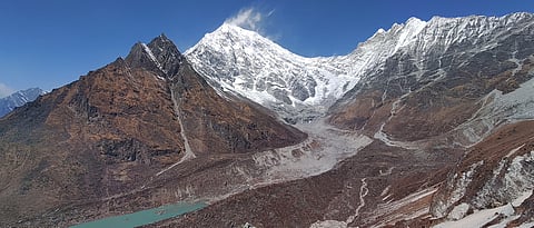
Let me break this down. First, the question of what happened in Nepal on August 26. The images that all of us would have seen are of the mountain coming down—just collapsing—as the flash flood and massive quantity of debris buried everything in its path, taking with it the massive building of the Chinese immigration office. It is a frightening visual, straight out of a science-fiction movie. We know now that this flash flood was not caused by an extreme cloudburst. It was triggered by the collapse of a high-altitude glacier near the Langtang Lirung peak. An estimated 142 million cubic metres of ice and rocks were dislodged, creating a 5.2 magnitude seismic event. This then led to the formation of natural dams, behind which water and moraine accumulated, and when the dams broke, they unleashed even more devastating floods downstream.

Nepal Floods: What we now know about the glacier collapse
Second question is, why? There is no single headline reason, but two events have greatly contributed to this and other such tragedies in this region. One is the well-documented warming caused by climate change. It is literally weakening the Himalayas—the temperature rise melts glac-iers; this, in turn, corrodes the moraine slopes. It is a ticking bomb which implodes as it did in Nepal. In addition, climate change is leading to increased frequency and intensity of extreme weather events, which in turn brings flood and landslide catastrophes, like those seen in Himachal Pradesh in 2025, in Sikkim in 2024 and in Chamoli in 2021. But just so you know, even as I write this and as we watch images of Nepal on our screens, similar floods are happening in different parts of the Himalayas.
Nepal floods is not simply a natural disaster. It is a warning about climate change, reckless development and our belief that nature can be controlled
We are complicit in this; all of us, but particularly the countries that have contributed the most to the stock of greenhouse emissions in the atmosphere, which, in turn, is driving up temperatures and causing runaway devastations. This is about the past, the present and the future. There is no getting away from the historical responsibility of the richest and most developed countries for this loss of lives. And even as the death toll was rising in Nepal, we got the news that the world was no longer even on an illusionary track to stay below the guardrail of 1.5°C temperature rise since the industrial period of 1870. UNEP estimates that the world will overshoot this threshold within a few years. Scientists know that beyond 1.5°C, the impacts would be cascading and even more devastating—from the collapse of ice sheets to disruptions in ocean currents like the Atlantic Meridional Overtaking Circulation (AMOC), and much more. The intense heat, fires and other weather abnormalities we saw this summer were only a preview of what awaits us. Yet, we seem to be sanguine about this breakdown in our Earth’s system.
Today, we are so distracted by economic and livelihood concerns brought on by deliberate human misdeeds like senseless wars that this enormous and existential crisis seems distant and insignificant. We are merely tinkering with emissions, not transforming it to live within na-ture’s bounds.
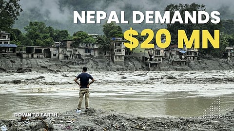
Nepal demands climate justice after deadly floods | $20 million compensation claim
Let’s get back to the Himalayas. We know that the climate change ticking bomb is exacerbated by the “nature” of development in these eco-logical hotspots. We talk ad nauseam about adaptation and about how we must take the changing climate into account, but we never do. We really believe that we can continue to do what we do, without consequences. Take for example the hydroelectric projects being constructed by damming narrow rivers. As I have said in the past, and will repeat, this is not about the dam development, but about the recklessness with which they are being developed. In the Indian Himalayas, project after project is coming up—literally back-to-back—so that the Ganga is re-engineered. It will cease to flow naturally, as these projects will regulate its water, taking it to generate electricity and then releasing it back. Then we are tunnelling into the mountains and building roads, often without provision for slope management. I can go on.
But the fact is we are not hearing the message that nature is giving us, loud and clear: change your mindset; your thinking that you can dominate me, bring me to my knees will not work. Change or perish is the message. The question is if we can hear it amid the cacopho-ny of our distractions.
Subscribe to our daily bulletinShow Comments
Related Editorials
Himalayan blunders and beyond
7 hours ago

Plastic regime needs transparency
31 Aug 2026

My unfinished agenda
17 Aug 2026

Inclusion is sustainability
24 Jul 2026
The coming years may bring catastrophic weather that could be ‘far worse’ than history suggests: King’s College London
Historical records of the deadliest storms and heatwaves may be a poor indicator of the scale and impact future weather disasters could have, warn scientists

Cyclone Nargis, which killed almost 140,000 people in Myanmar in 2008, caused more than twice as many deaths as the other 675 deadly tropical cyclones of the 2000-2025 period combined.Photo Courtesy: NASA

Published on:
11 Sep 2026, 1:29 am
Listen to this article
Summary
- Scientists at King’s College London warn that future climate disasters could be far worse than history suggests, as current ‘what-if’ risk tools fail to capture unprecedented extremes.
- A Nature Sustainability paper shows most deaths from 2000-2025 came from a few massive cyclones and heatwaves, urging new methods to anticipate rare, catastrophic events that could kill millions.
The years ahead may bring climate catastrophes the scale and impact of which cannot be fathomed by the planning tools available at the moment, scientists at King’s College London warned on September 10, 2026.
According to the experts, the ‘what-if’ scenarios now widely used in risk assessment are not designed to identify, and therefore prevent, worst possible outcomes, such as greater death tolls, and more severe impacts on infrastructure and people’s health
The warning comes after a summer in which thousands of excess deaths were recorded across Europe during the June heatwaves alone and amid current analysis on how the El Nino weather phenomenon could bring more extreme weather worldwide, with very significant impacts possible within the UK.
The peer-reviewed perspective paper, published in Nature Sustainability, analysed deaths from every recorded tropical cyclone and extreme heat event between 2000 and 2025 worldwide. The findings suggest that the vast majority of deaths occurred from a handful of enormous events and suggests that future incidences could be far worse than human intuition suggests.
The paper highlights that Cyclone Nargis, which killed almost 140,000 people in Myanmar in 2008, caused more than twice as many deaths as the other 675 deadly tropical cyclones of the 2000-2025 period combined.
Similarly, heatwave deaths were concentrated within just a few deadly events, the most lethal being in Europe in 2003, when around 70,000 people were killed—with almost half the deaths occurring within the first two weeks of August.
Focussing on extreme heat and cyclones to illustrate the scale of potential worst-case events, the analysis suggested that it was difficult to rule out very rare future events generating death tolls in the millions, though they stress that just because this might be possible does not necessarily mean it is likely.
Tom Matthews, Senior Lecturer in Environmental Geography at King’s College London and lead author said: “History is almost guaranteed to make us underestimate future risk. The events that have shaped our sense of what extreme weather can do are not the worst that can happen. They are the worst that have happened so far, in a short record, in a climate that no longer exists.”
“Current approaches to climate risk assessment are generally good at considering familiar hazards like hurricanes of unfamiliar intensity (for instance, having higher wind speeds) the authors say, but not for pre-empting events without any sort of precedent, for example, a devastating heatwave just before a strong hurricane – when many millions could be evacuating and not have the future protection of air conditioning,” a statement from King’s College London noted.
Matthews added: “We are asking the research community to treat the discovery of unknown catastrophic events as a scientific objective in its own right.
“That means working backwards from an outcome nobody wants and asking what could produce it, and it means bringing in people who are not usually in the room, such as those who can harness the power of human imagination, such as risk scholars and writers of climate fiction.”
The authors have set out three main priorities to help pre-empt, and prevent, very severe impacts from extreme weather events: horizon scans conducted by participants with diverse expertise to help leverage the power of human imagination, including existential-risk scholars, frontline communities, insurers, climate-fiction writers, and climate modellers; better understanding of the thresholds beyond which impacts grow very steeply; and mapping the physical limits of weather in climates far hotter, and far colder, than today’s.
Subscribe to our daily bulletinShow Comments
Related Stories

Nepal’s flood is a warning about the missing architecture of Himalayan cooperation
08 Sep 2026
The entire Himalayan region needs a robust, operational early warning system for cryosphere-related hazards
07 Sep 2026
Two years, two floods: A vulnerable Himalayan corridor faces growing risk
04 Sep 2026

More trees are needed to cool down European cities in heatwaves — but they must be planted nearer to homes
02 Sep 2026
From drought to floods in North Africa: What could the super El Niño do next?
The answer lies thousands of kilometres away, over the North Atlantic

Photo for representation.iStock

Published on:
09 Sep 2026, 11:12 pm
Listen to this article
Morocco spent most of the last decade drying out. Between 2019 and 2024, the country recorded six consecutive years of below-average rainfall, the longest on record. The 2023-24 hydrological year was the driest in more than six decades, with a national total of just 106.4 mm.
But this was not simply another dry spell. The problem went far beyond rainfall. The squeeze was structural as much as meteorological: Per-capita renewable water availability has fallen to about 620 cubic metres a year, exacerbating water stress, while three decades of overuse significantly reduced water levels in several aquifers. Nothing about the autumn of 2025 suggested that was about to change.
Then came the winter of 2025–26.
The rain returned suddenly, and on a scale Morocco had not seen in a generation. Seven years of drought ended in a single winter. Severely depleted reservoirs began filling rapidly. Rivers that had run dry started flowing again.
Now, a record-breaking El Niño is developing in the Pacific. Could it send northwestern Africa back into drought? Analysis by my colleagues and me suggests otherwise. The answer lies thousands of kilometres away, over the North Atlantic.
What changed?
Most of Morocco’s rain arrives in winter, carried by Atlantic storms. How many of them reach the country depends in part on the North Atlantic Oscillation, the pressure difference between the Azores and Iceland which sets the speed and position of the jet stream, the high-altitude current that acts like a highway for weather systems.
When that pressure difference is big, the jet stream tends to run faster and farther north, carrying storms toward northern Europe. When it weakens, the jet stream can shift southward. That is essentially what happened through the winter of 2025–26.
Pressure fell around the Azores and rose near Iceland, and the jet stream responded by meandering deep into the subtropics. Its fastest core shifted toward the Moroccan coast rather than remaining farther north toward the British Isles. We identified this combination as a distinctive weather pattern for northwestern Africa: A weakened pressure gradient, a southward-displaced jet stream and Atlantic storms repeatedly reaching Morocco.
That redirected the storm track toward Morocco. One storm after another arrived from the Atlantic, bringing moist air and more rain to already wet ground. The Rif and Atlas mountains pushed this moist air upward, producing even heavier rainfall, particularly over the Sebou basin in the country’s northeast.
What could a super El Niño mean?
The tropical Pacific is undergoing a dramatic shift toward a super El Niño. The U.S. National Oceanic and Atmospheric Administration now puts the odds of a very strong El Niño this winter above 90 per cent, with most models pointing toward an exceptionally strong event. That immediately raises a couple of important questions for Morocco.
Does a super El Niño mean another wet winter? Or could drought return?
We cannot say yet. The reason is that El Niño is only one part of the story. The Pacific Ocean can influence the odds. But for Morocco, the North Atlantic may ultimately determine where the storms go.
Strong El Niño winters tend to push the North Atlantic Oscillation toward its negative phase late in the season, which can shift Atlantic storms farther south. Wetter early winters over Iberia have also been linked to El Niño.
If those pieces fall into place this winter, the Azores-Iceland pressure gradient could weaken again. The jet stream could shift southward, allowing more Atlantic storms to reach Morocco and other parts of northwestern Africa. In other words, a strong El Niño could increase the chances of another wet winter. But there is a catch.
Effects in North Atlantic
The Atlantic may not follow the Pacific. El Niño does not control the North Atlantic like an on–off switch. The Pacific’s signal reaches Europe indirectly and inconsistently, and it competes with the North Atlantic’s own powerful internal variability.
This helps explain why decades of research has struggled to identify a simple and reliable El Niño fingerprint over the Mediterranean. Our analysis of the winter of 2025–26 illustrates this uncertainty particularly well. Despite the dramatic shift in atmospheric circulation that brought rain back to Morocco, the Pacific and the North Atlantic Oscillation were effectively unrelated. That indicates the wet winter was driven primarily by what was happening over the North Atlantic, rather than by a clear signal coming from the tropical Pacific.
And the rule book keeps changing. El Niño’s grip on North African rainfall appears to have tightened since 2000 as the two oceans fell into step, but that coupling has drifted in and out of phase for as long as we have measured it.
A relationship that shifts across decades makes a poor guide to a single winter. The 2023–24 El Niño provides a useful warning. During that strong event, forecasters expected the North Atlantic Oscillation to shift into its negative phase. It never did.
So, could northwestern Africa slide back into drought? Yes, but not simply because of El Niño.
After seven years of drought and one extraordinary wet winter, northwestern Africa now faces another season of uncertainty. El Niño may change the odds, but it does not decide the outcome. El Niño might load the dice but the North Atlantic throws them.


Leave a Reply